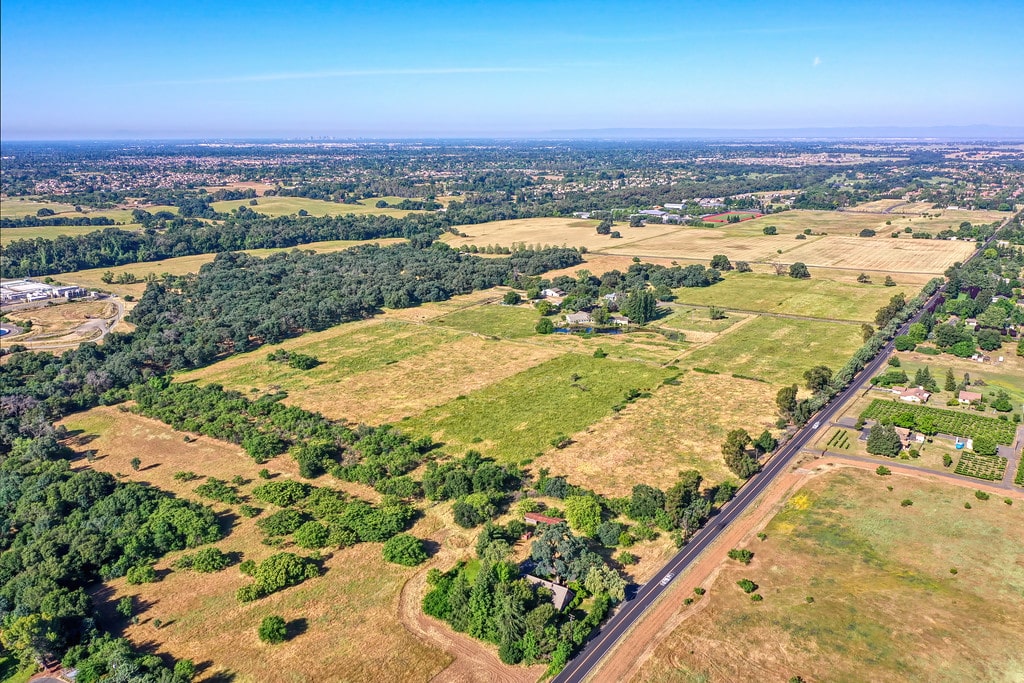
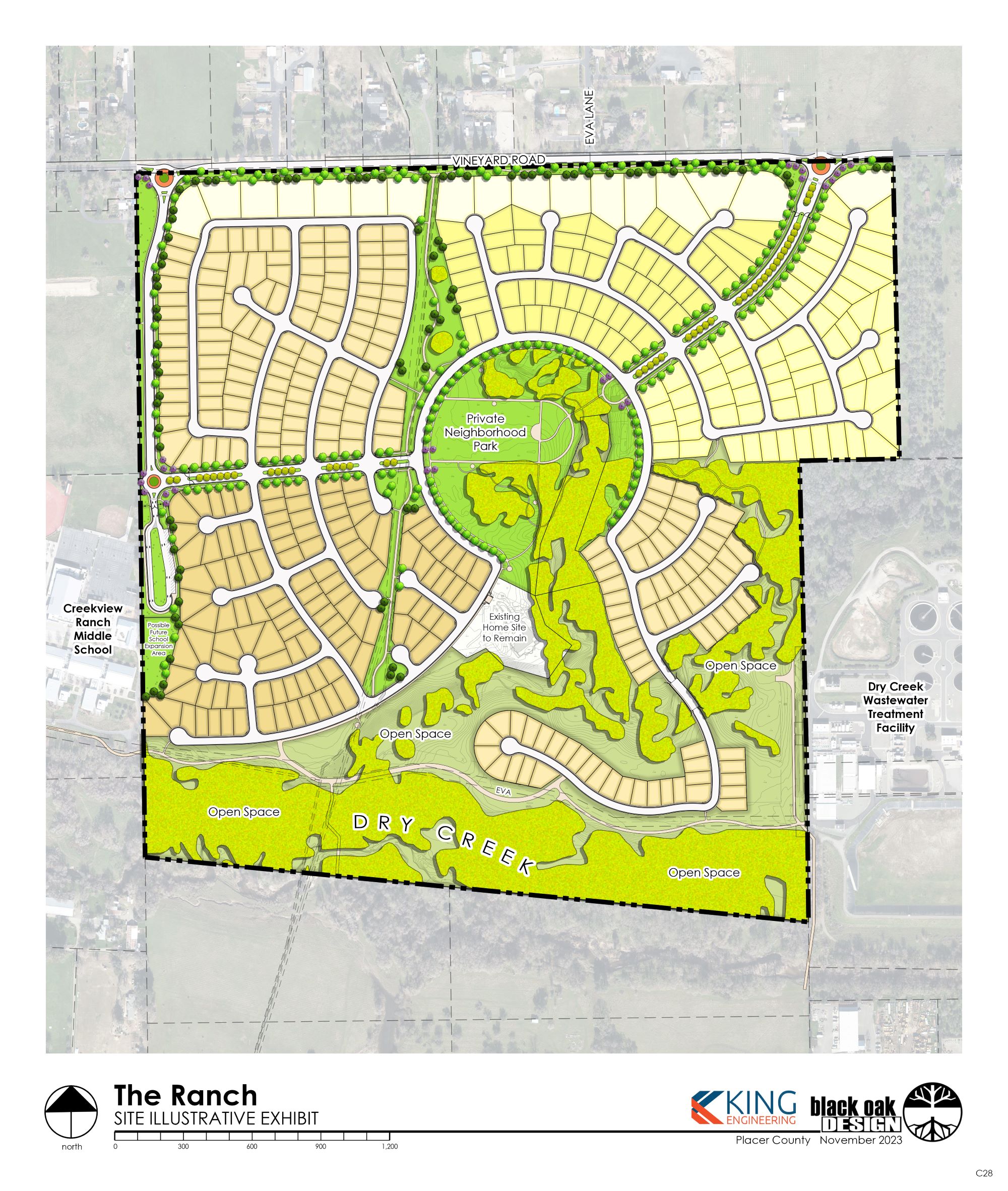
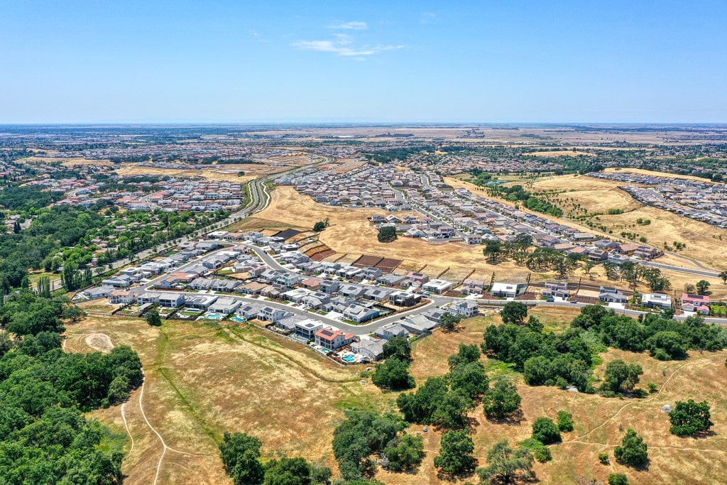
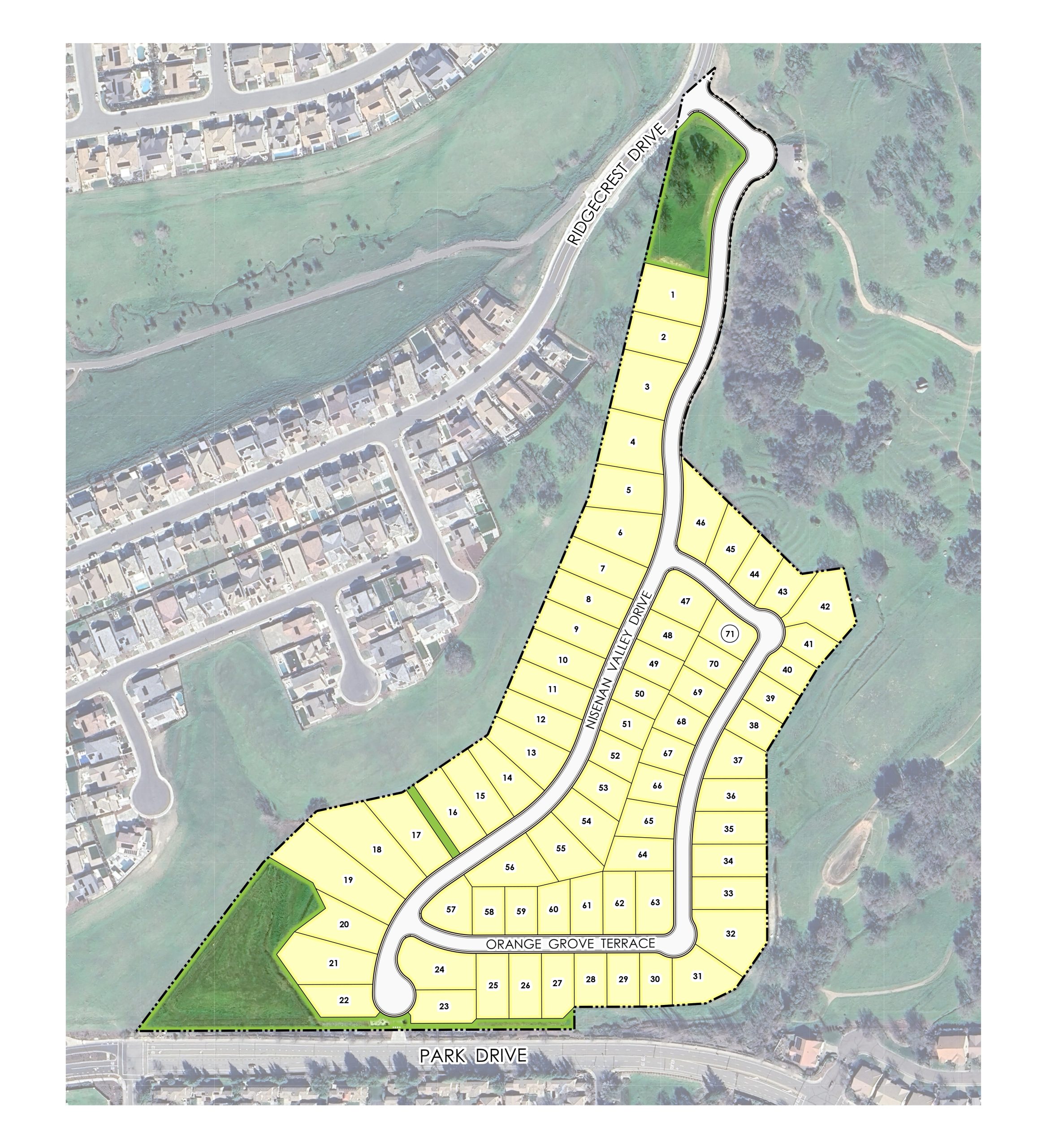
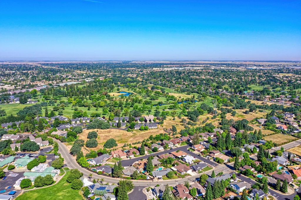
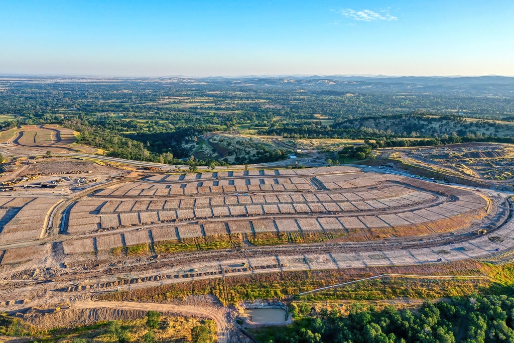
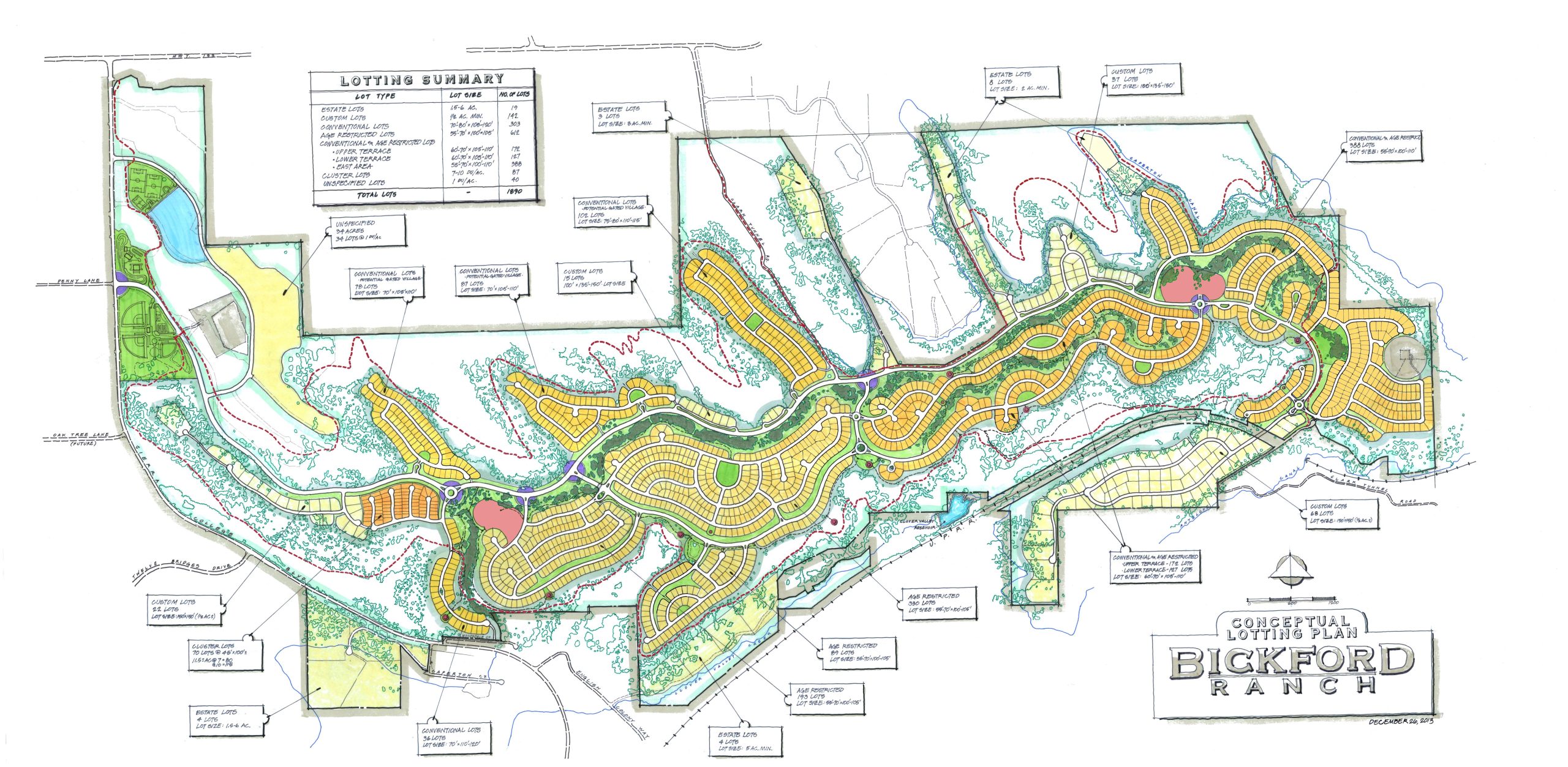
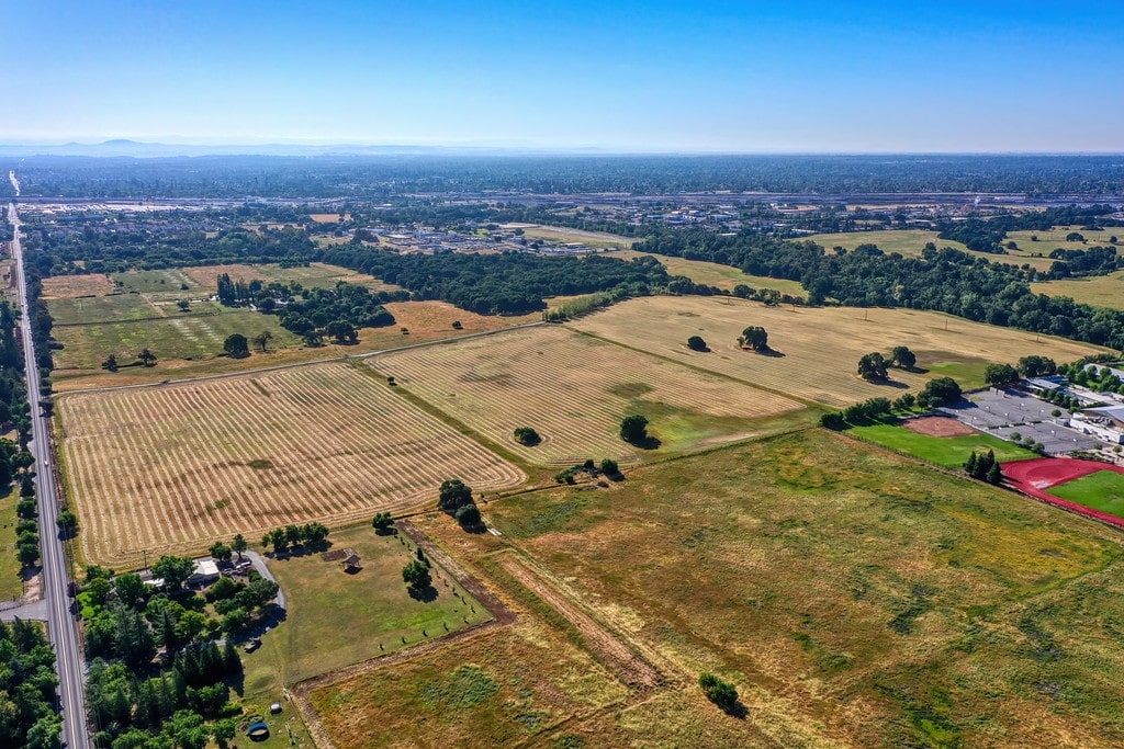
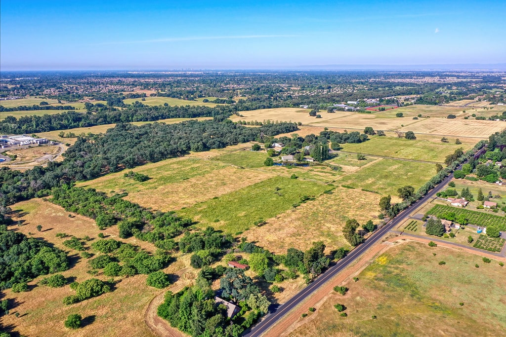
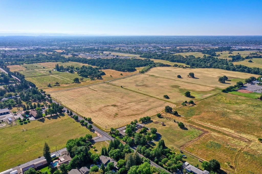
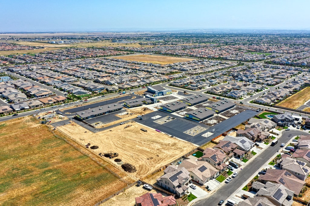
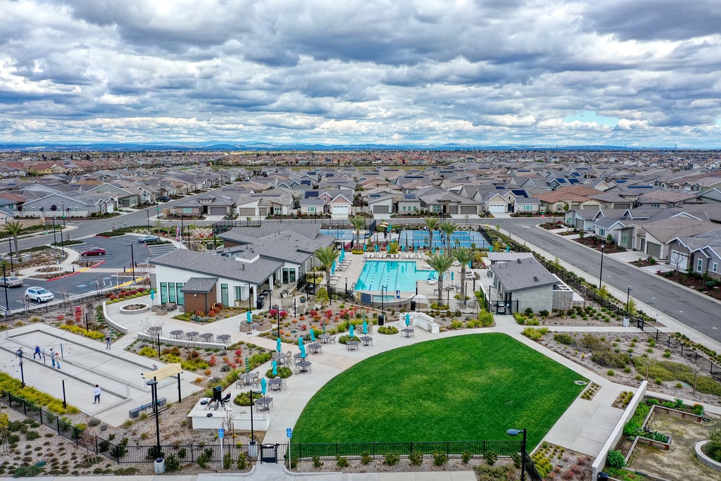
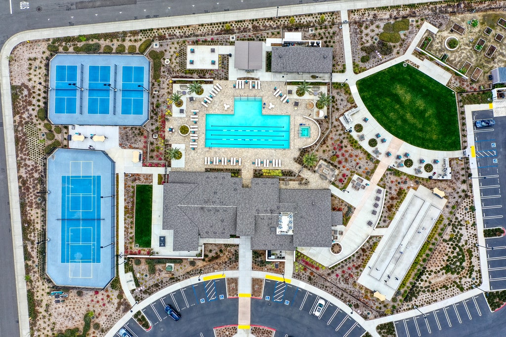
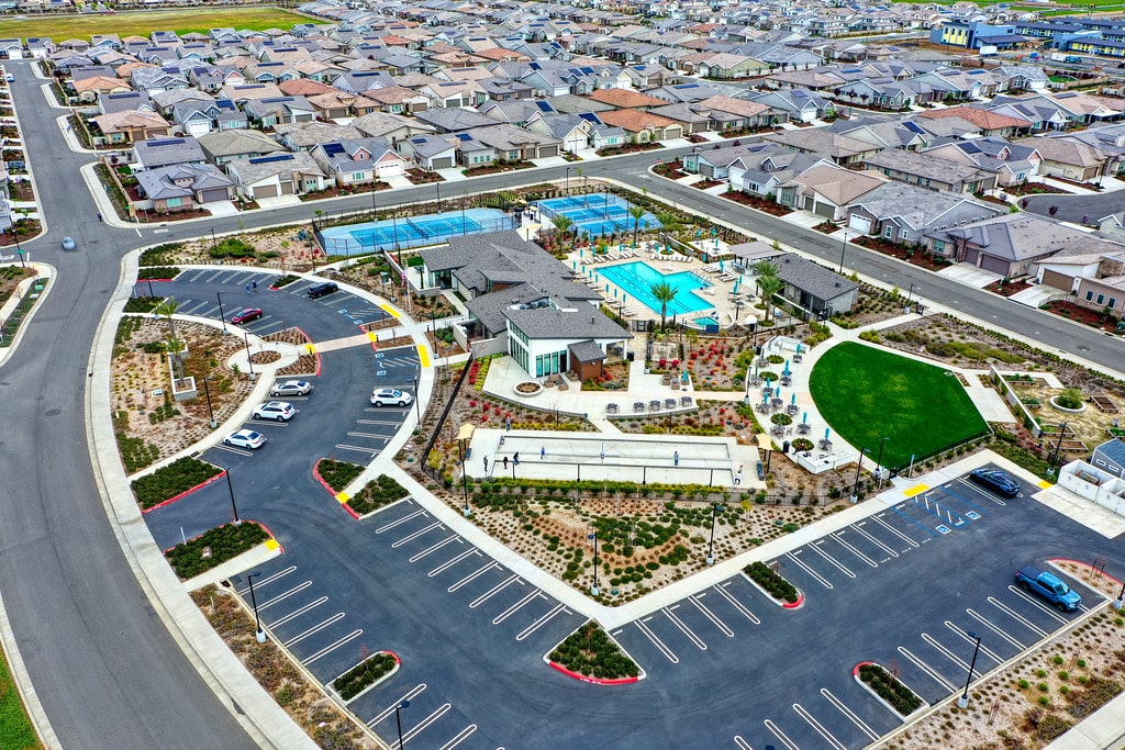
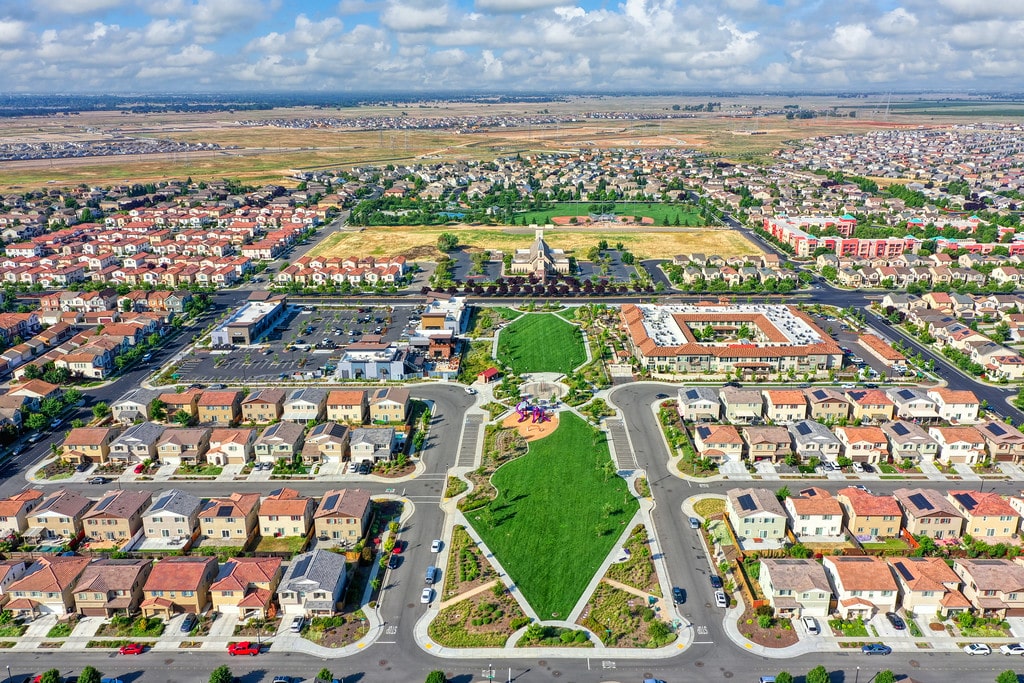
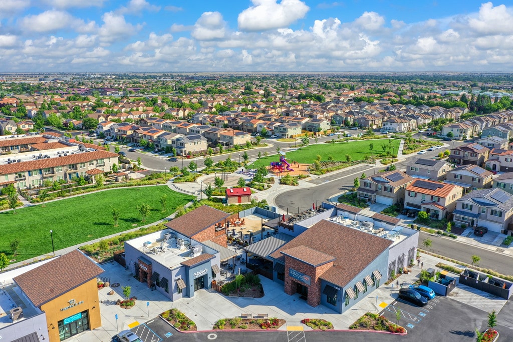
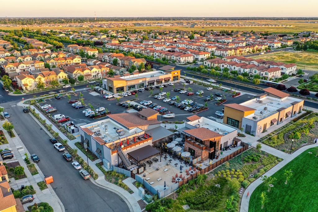
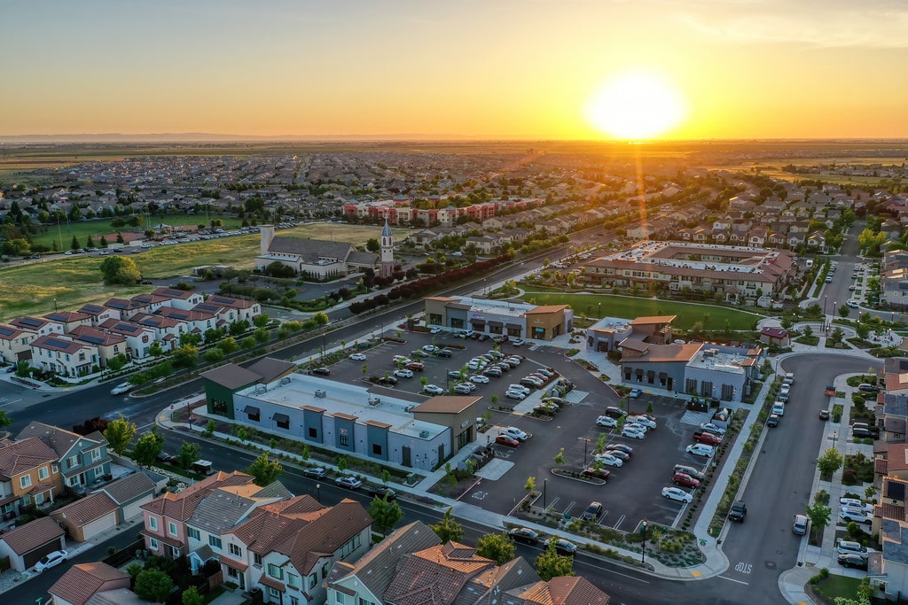
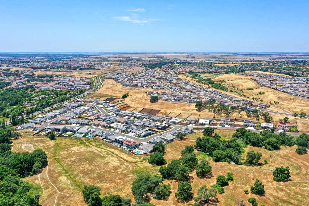
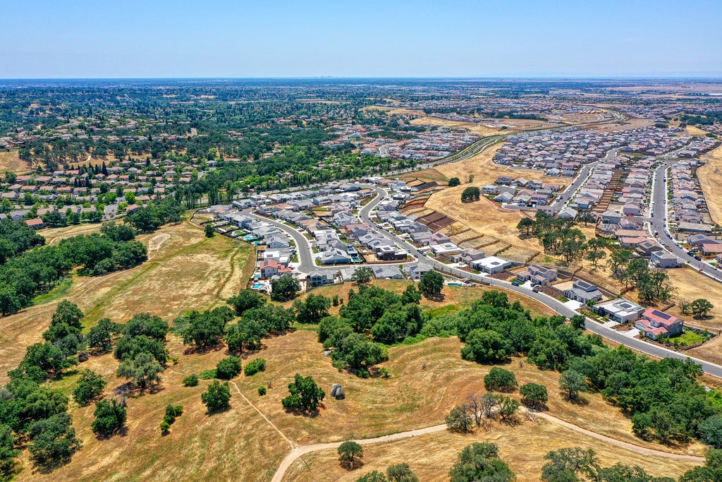
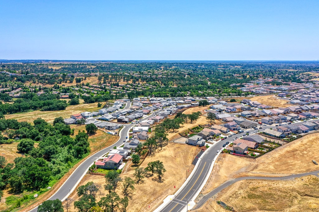
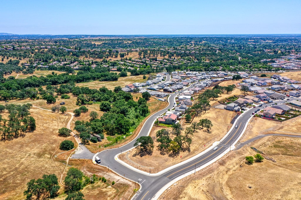
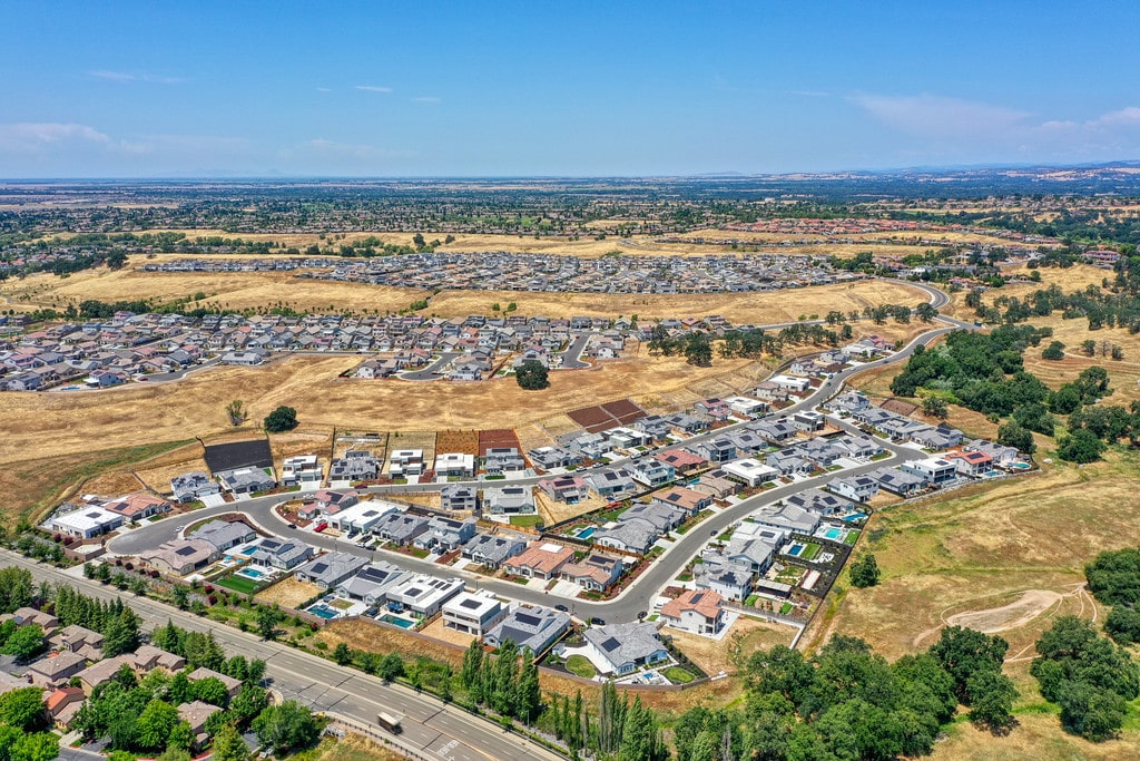
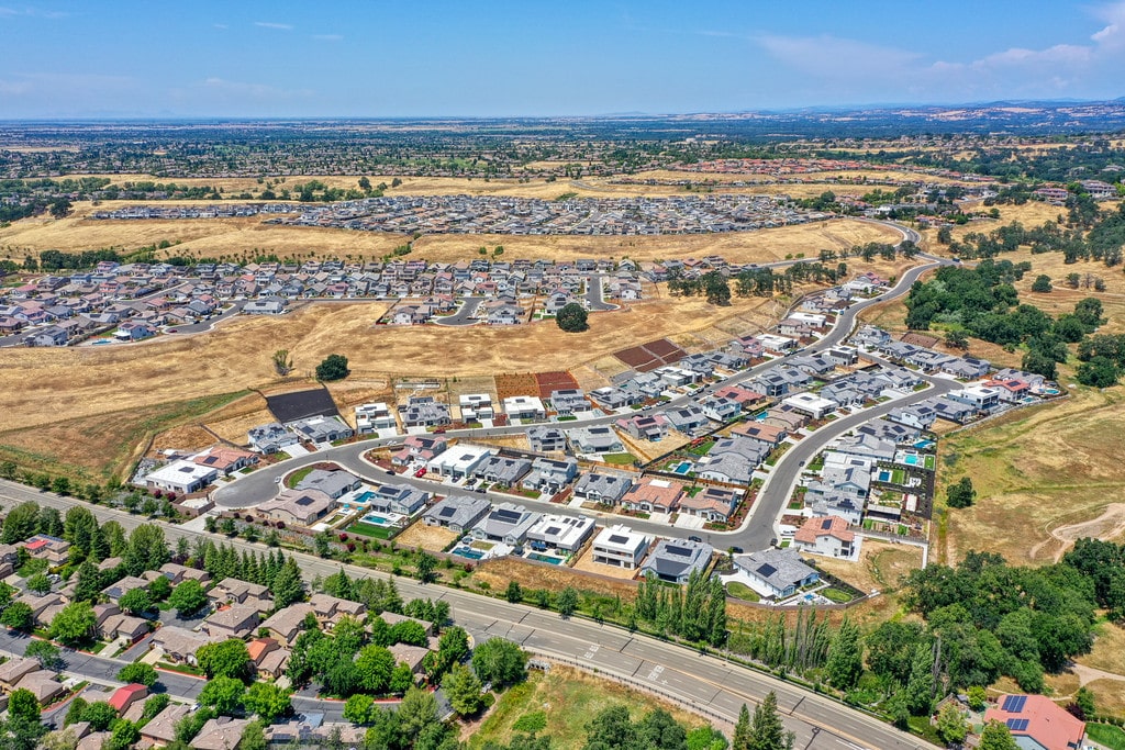
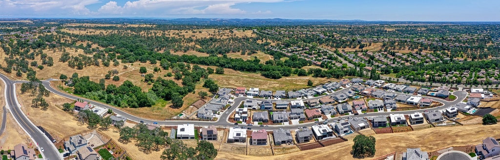
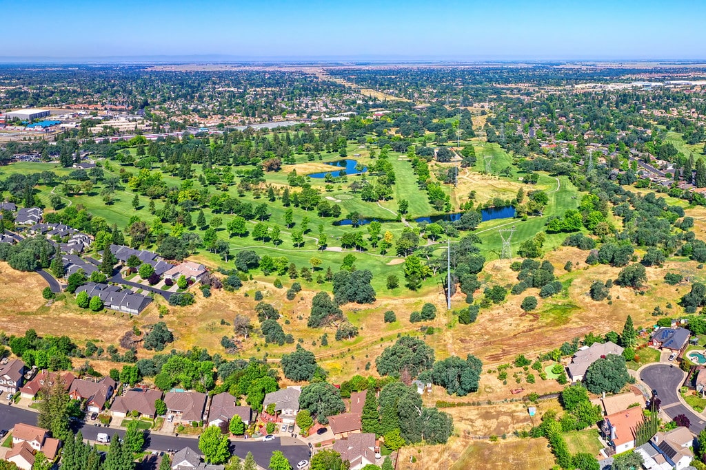
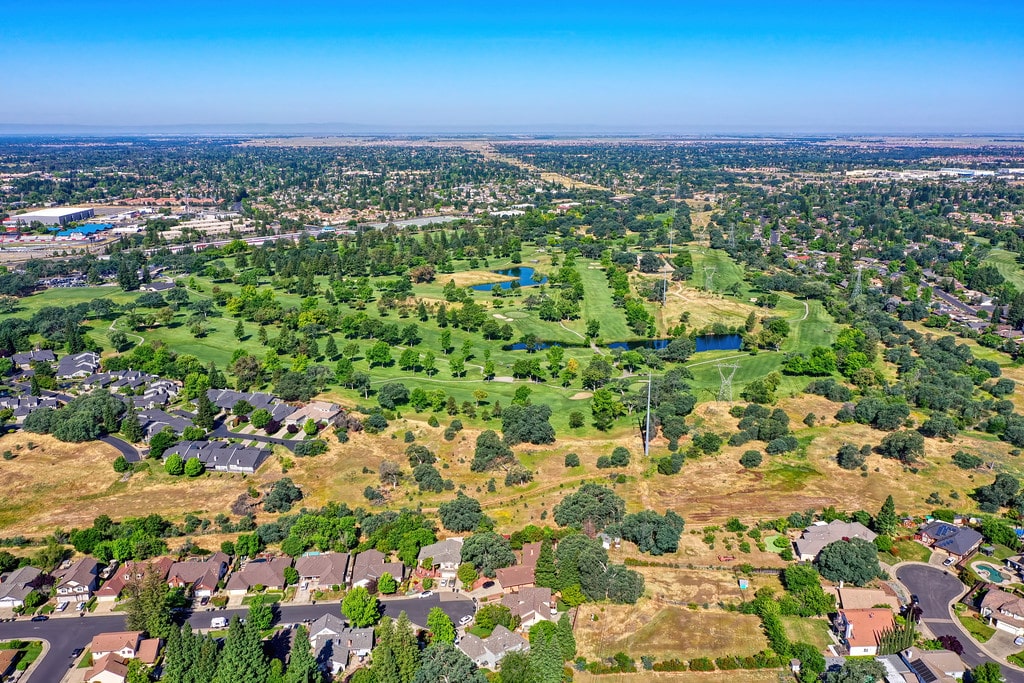
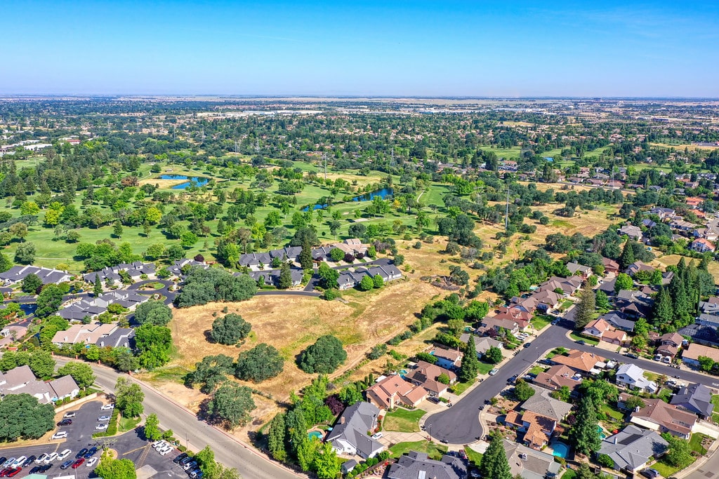
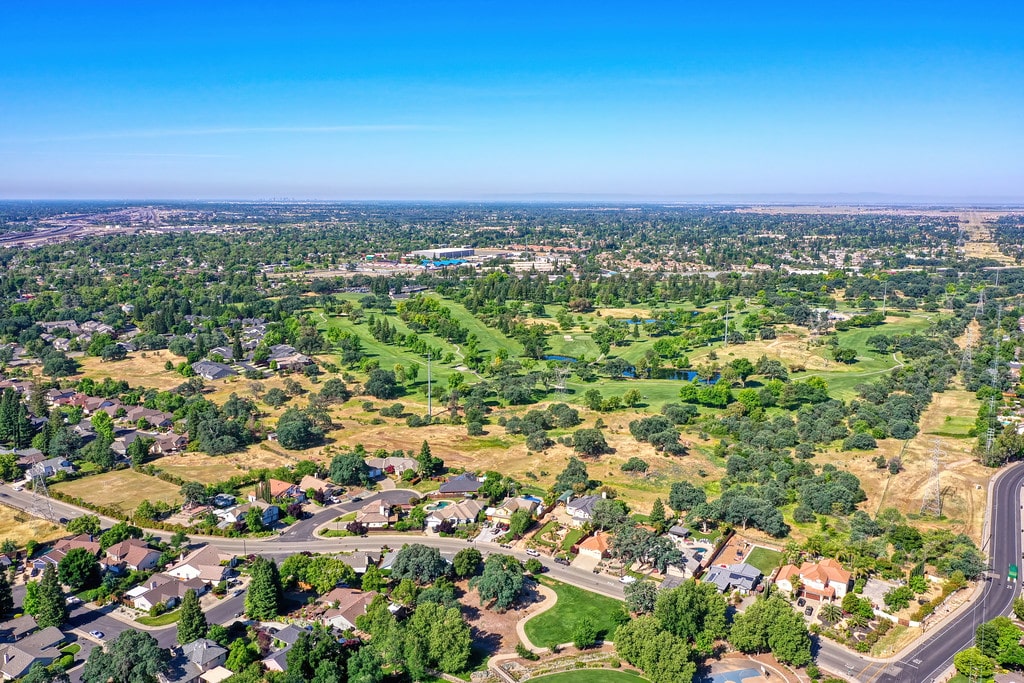
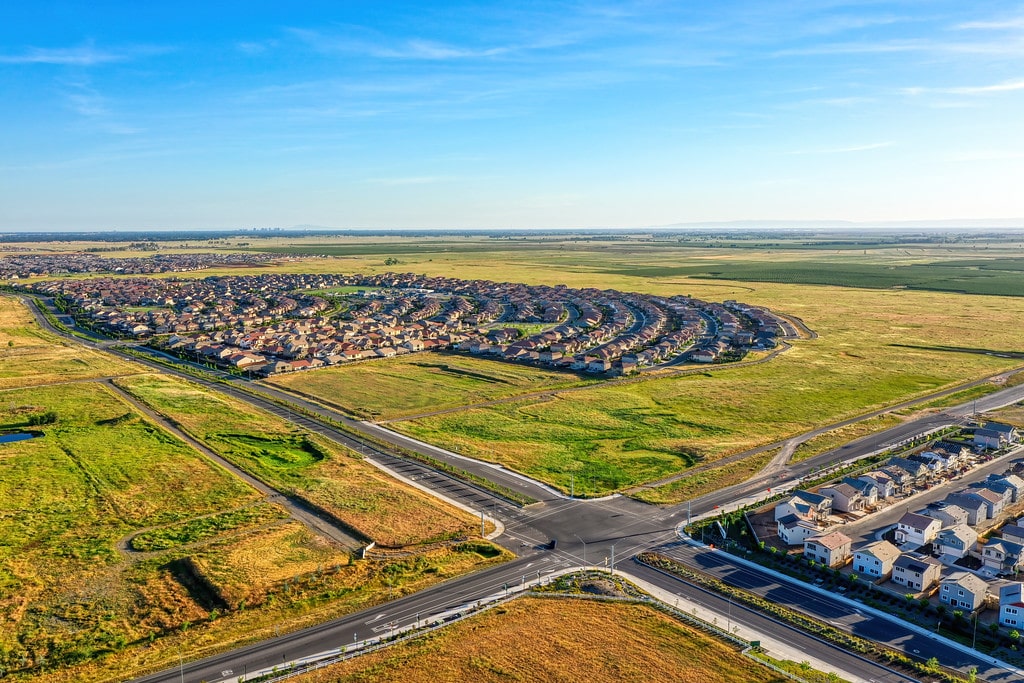
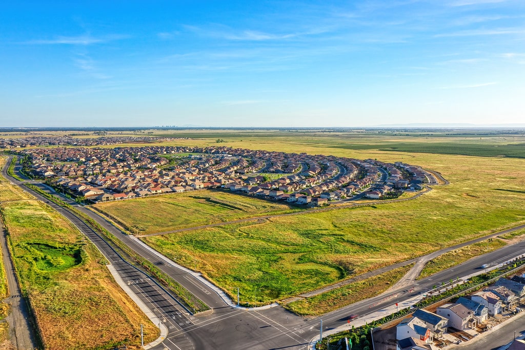
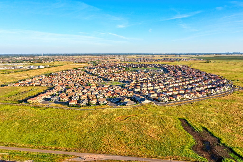
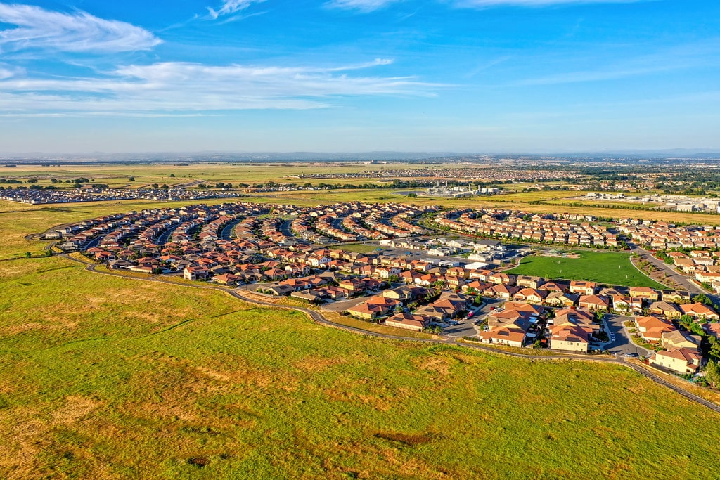
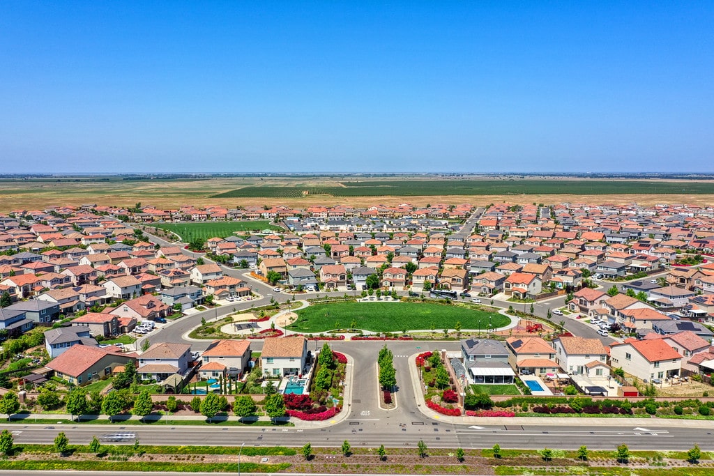
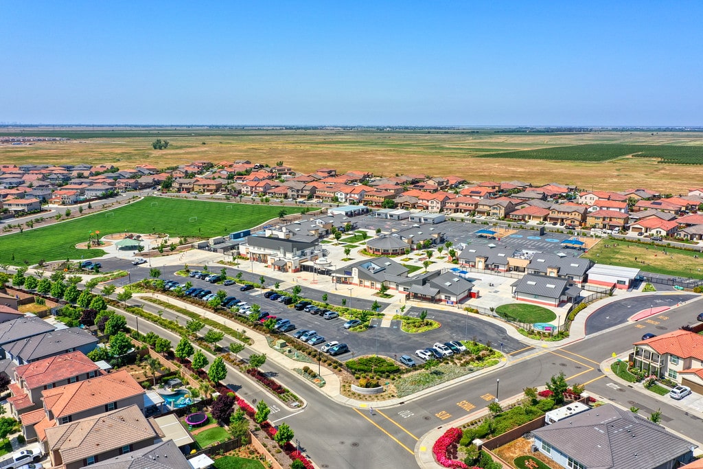
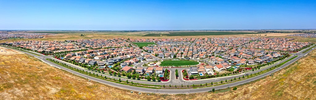
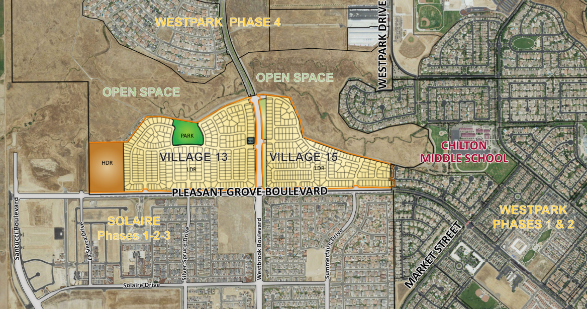
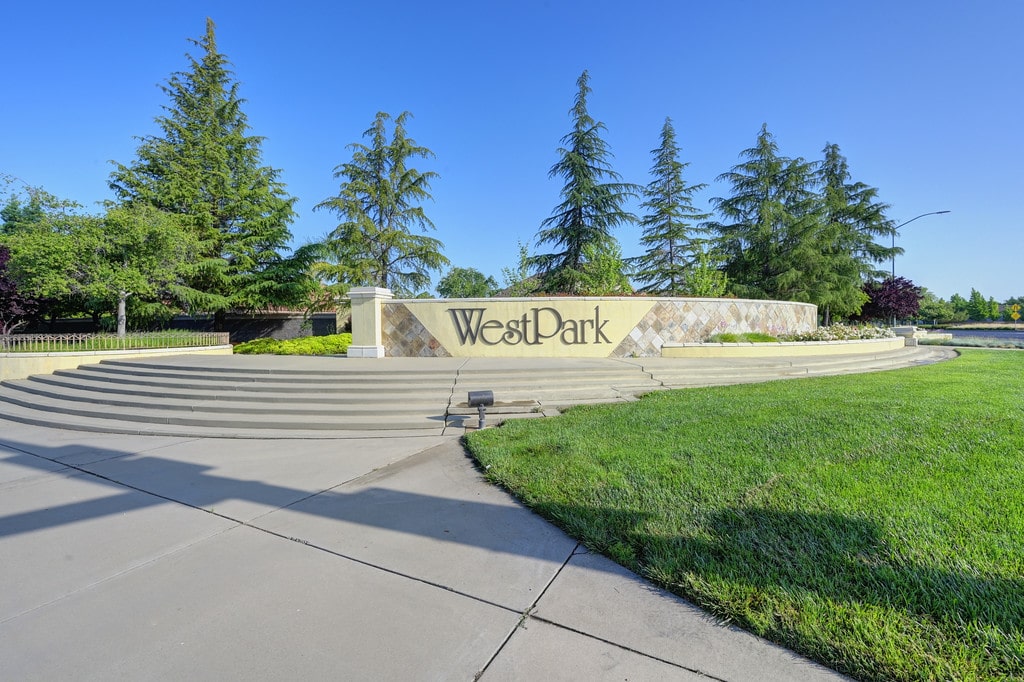
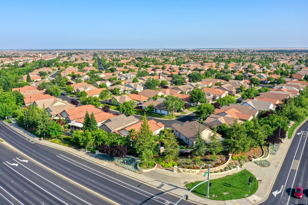
The Ranch

OVERVIEW

The Setzer property, processing through Placer County under the planning name, The Ranch is a 220+ acre property located in the Dry Creek Community in southwestern Placer County.  The property is the last large undeveloped parcel under single ownership in this portion of the County.  Westpark is engaged with the family to manage and process the property through the complex entitlement process to obtain a General Plan Amendment, Community Plan Amendment, Rezone and EIR.  In addition, Westpark will process the wetland permits through the Placer County Conservation Plan recently approved by the state and federal regulatory agencies granting permitting responsibility to the County. 

Recognizing the community’s sensitivity to growth, Westpark engaged in public outreach immediately after submitting an application to the County.  Westpark returned to the local Municipal Advisory Committee on three occasions to present revisions to the original proposal.  When faced with continued concern by the community Westpark approached key stakeholders in the community to engage with us to work on a community design that they found addressed many of their initial concerns.  The revised plan was presented to the community that represented a smaller project with a more sensitive interface to the existing community. 

Westpark will complete the entitlement process, and then prepare the land for sale to homebuilders.  Entitlements are expected in late 2024 with potential site work commencing in the summer of 2025.

LAND USES INCLUDE:

  • Residential 446 homes
  • School Site 2.8 acres
  • Park 15 acres
  • Open Space 77.5 acres
Land Use Map
Video

Solaire

OVERVIEW

Solare is a 650 acre master planned community located in the City of Roseville.  Westpark acquired the initial 400 acres in 2011 and immediately went to work on the entitlements submitting an application to the City requesting a General Plan Amendment, Specific Plan Amendment, Development Agreement and Large Lot Tentative Map to create 2,029 residential units (1,340 single-family lots and 689 multi-family units), 43 acres of retail commercial, 15.5 acres of park land, 10 acres for an elementary school, and 37 acres of open space. These entitlements were approved in June 2012. The first small lot tentative map for Solaire was approved in March 2014 and included 547 single-family lots. The 404 permit for Solaire was also issued in July 2014. In 2015 a portion of the land plan was revised to incorporate a 493 unit active adult community.  Subsequent Tentative Maps and backbone construction opened up Solaire Phases 1, 2, and 3 for development.

The second acquisition of property that comprised Solaire was acquired in 2019 and contained 250 acres with Specific Plan approval for 783 single family homesites and 172 high density residential units.  Development in this portion of Solaire commenced in 2020 with the first land sales occurring that year.  At buildout, Solaire will include 2,247 single family homes, more than 800 apartment homes and more than 14 acres of commercial property.

Homebuilders in Solaire include Woodside Homes, D.R. Horton, Lennar Homes, Taylor Morrison, Tri Pointe Homes, and K. Hovnanian Homes, Beazer Homes, and Pulte Home, who selected Solaire as its first new community in the Sacramento region after a nearly 10 year absence from the market.

In addition to being a participating landowner in the plan area, Westpark served as the project manager through an entitlement process that included approvals by the City of Roseville, negotiations with Placer County for the annexation of the property to the City of Roseville, application to the US Army Corps of Engineers for federal wetland permits, management of the preparation of a federal Environmental Impact Statement (EIS), negotiations with the US Fish and Wildlife Service for a biological opinion and incidental take permit to allow the development of the 6,650 units approved for the Sierra Vista Specific Plan area.

APPROVED LAND USES:

  • Active Adult, 493 units
  • Low Density Residential, 1,085 units
  • Medium Density Residential, 669 units
  • High Density Residential, 804 units
  • Commercial, 14.5 acres
  • Elementary School, 10.0 acres
  • Parks, 17.4 acres Open Space, 87 acres
Land Use Map
Video

Village Center

OVERVIEW

The Westpark Village Center is a 17-acre infill property located on Pleasant Grove Boulevard in the Westpark Community. The property was zoned for neighborhood commercial uses and a park and was undeveloped for over a decade. Westpark acquired this parcel in September 2016 and immediately began working with the community and the City of Roseville on a redesign that would provide for a mix of commercial, park, and medium-density residential uses. The approved land uses include two commercial parcels (approximately 3 acres each), a neighborhood park, and two medium-density residential parcels containing a total of 56 lots. In 2018, the 56 lots were sold to K. Hovnanian Homes. Park development happened soon thereafter. In 2017, the western commercial parcel was sold to Oakmont Senior Living. Oakmont completed construction in 2021. The eastern commercial parcel was sold to Creekview Investments, LLC in 2018.  The site is now fully developed and serves as an important community gathering space for the Westpark community.

APPROVED LAND USES INCLUDE:

  • Medium Density Residential,56 units
  • Community Commercial, 6.4 acres
  • Park, 3.3 acres
Land Use Map
Video

Twelve Bridges

OVERVIEW

Westpark purchased this property from the Western Placer Education Foundation in 2005. The Western Placer Education Foundation used the sale proceeds to support the Western Placer Unified School District, including the Outdoor Learning Education Property in Twelve Bridges. Westpark rezoned and mapped the property for 71 residential lots. The 71 estate lots range in size from 8,000 square feet to 29,000 square feet. This property is located in the master-planned Twelve Bridges community. In 2018, the property was sold to K. Hovnanian Homes and is now built out.

Land Use Map
Video

Sierra View

OVERVIEW

Sierra View Country Club was founded in the 1950 and developed as a private 18 hole country club.  All of the land acquired for the club was not used to build the course leaving a large vacant parcel on the east side of the course.  Over the years the Club viewed this property as potential development land where a golf oriented community could be built nearby to provide housing for Club members and a source of funding for improvements to the club.  In early 1980 the club worked with a developer who envisioned a community of townhomes connected to the club by pathways.  Unfortunately for the club this first effort ended as a result of the recession, high interest rates and market conditions.  In 2005 the Club again explored options to develop the land for the benefit of the club.  Numerous efforts never got off the ground but global economic conditions muted interest in the property. 

In 2020 a member of the club approach Westpark seeking advice on what could be done with the property.  After a number of false starts working with others, the club sought an option that gave them more control of the outcome without the need to make the significant investment required to obtain the entitlements for the property.  Westpark proposed a unique arrangement to provide the expertise and funding to obtain entitlements and all regulatory permits while allowing the club to benefit from the enhanced value of the land that would come with these approvals.  Westpark set out to design a community that would check the box on a number of objectives the club had for the property. 

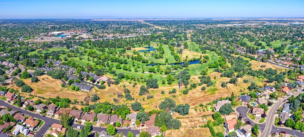
In November 2020, Westpark prepared a plan for the property and initiated a series of meetings with immediate neighbors to the property.  As is typical of infill development community interest was high and there was much discussion about the “open space” that neighbors had enjoyed for years, though the property had been designated for residential development since at least the early 1990’s.  After a number of meetings with neighbors and with input from the club a plan was developed and submitted to the City of Roseville.

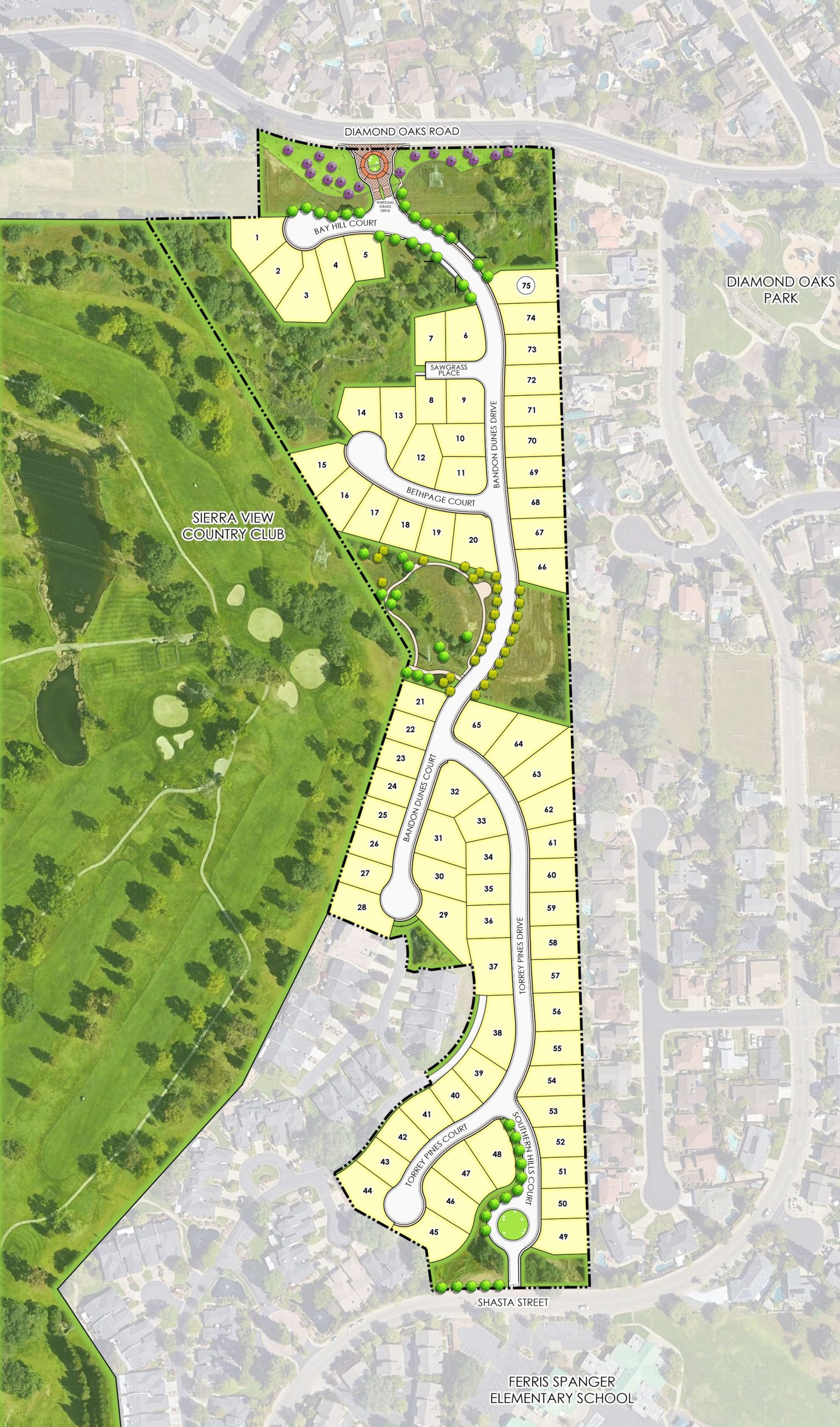
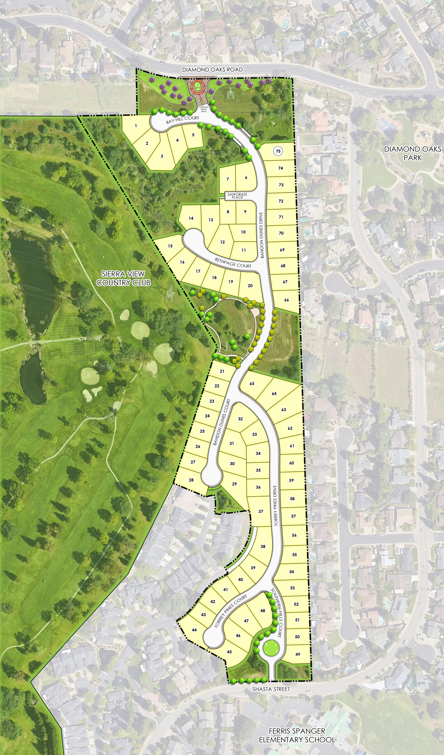
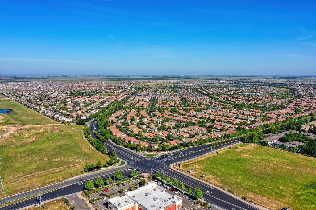
The entitlements included a General Plan Amendment, Rezone and a small lot and large lot tentative maps.  Westpark obtained final approvals in February 2022. 

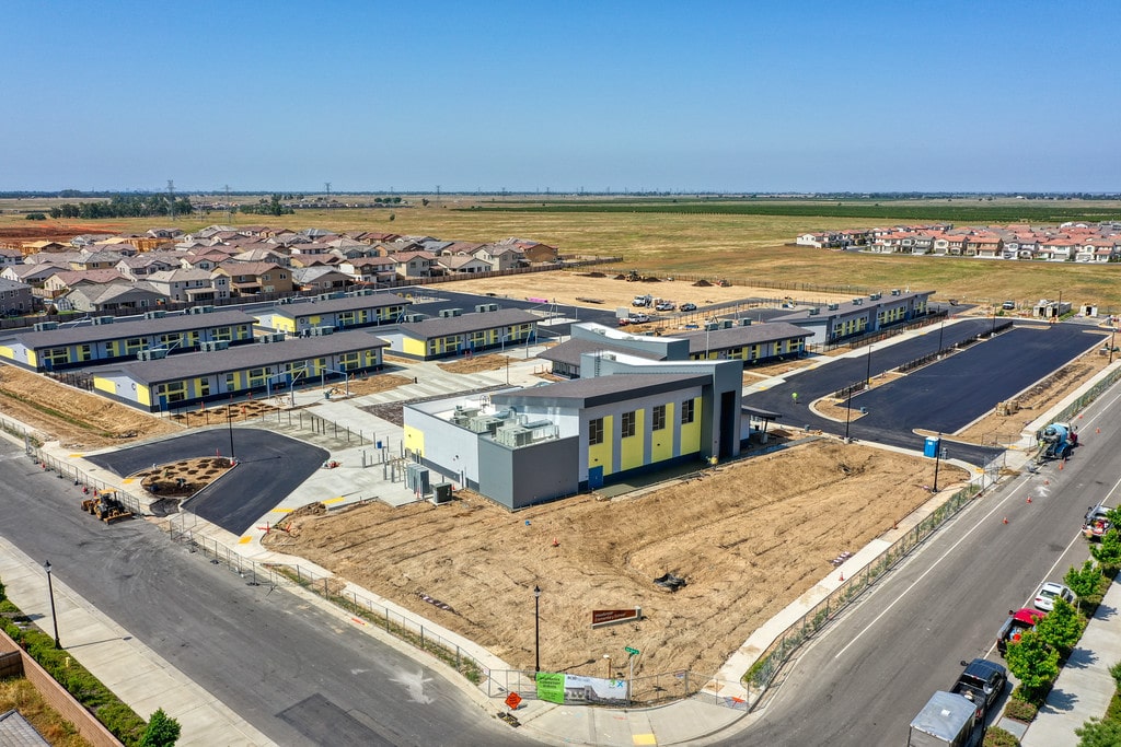
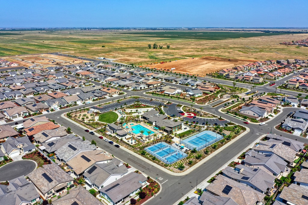
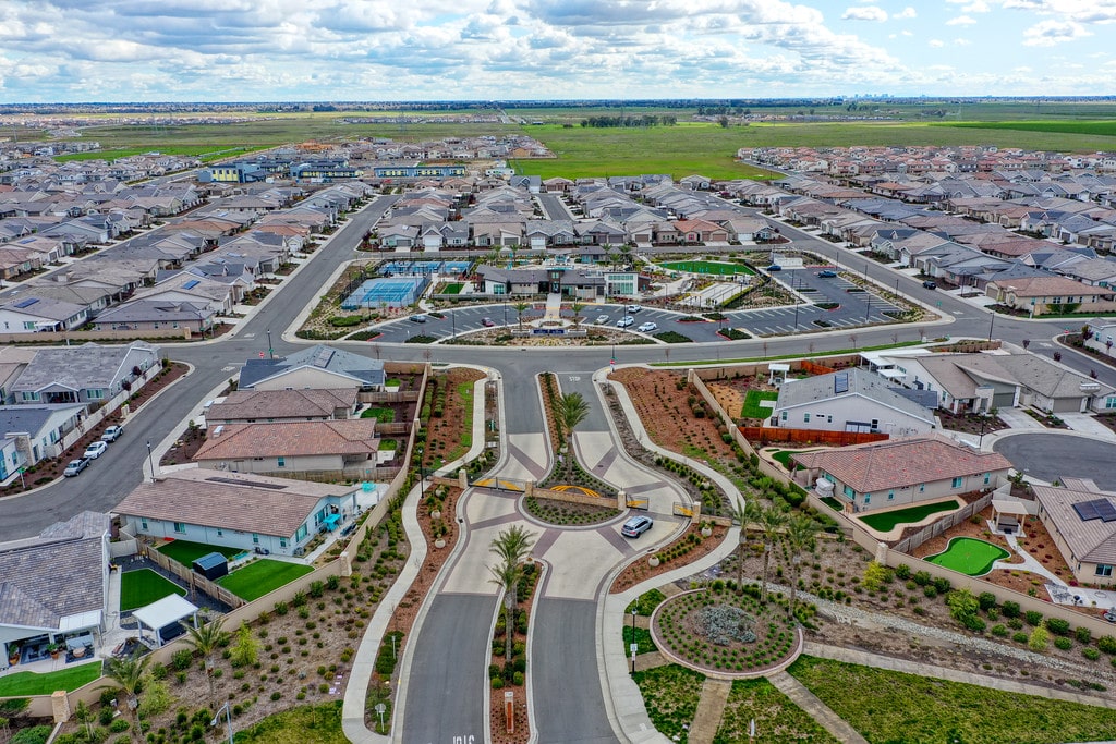
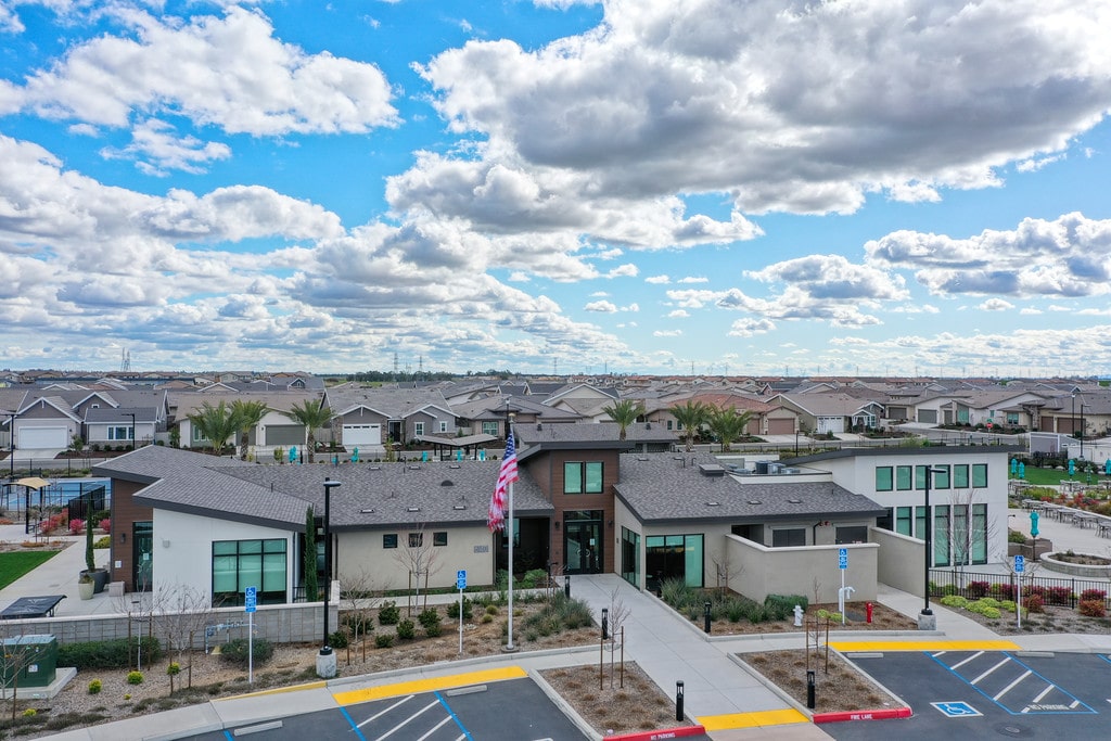
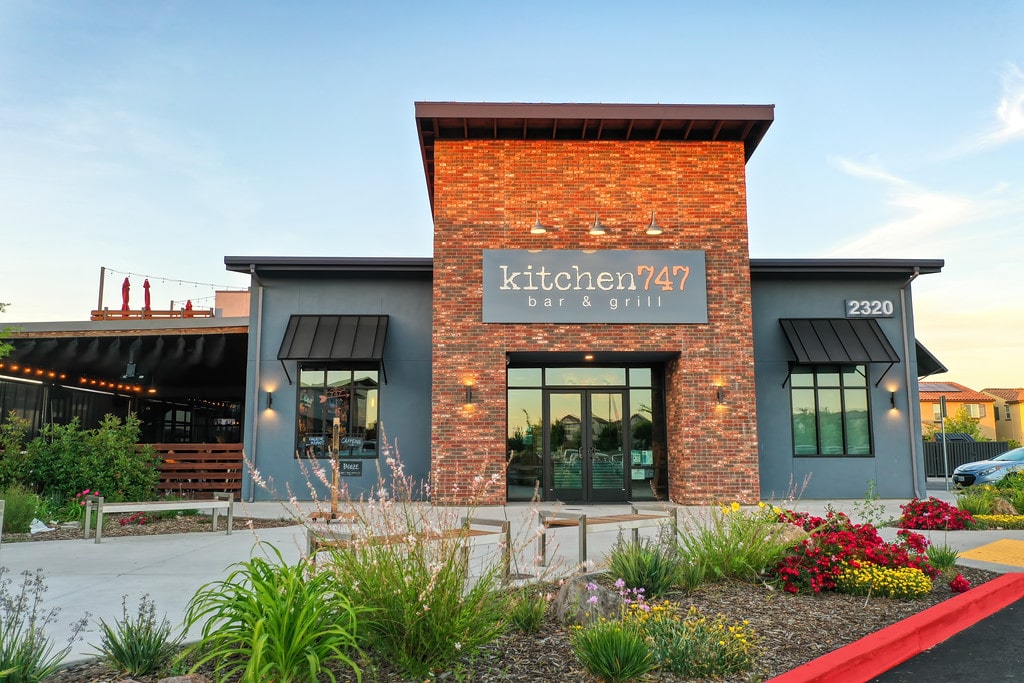
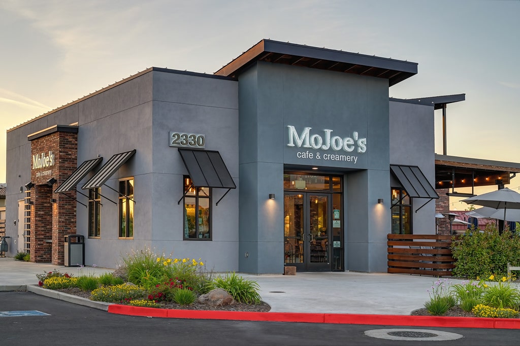
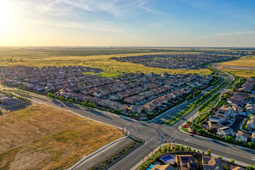
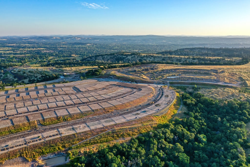
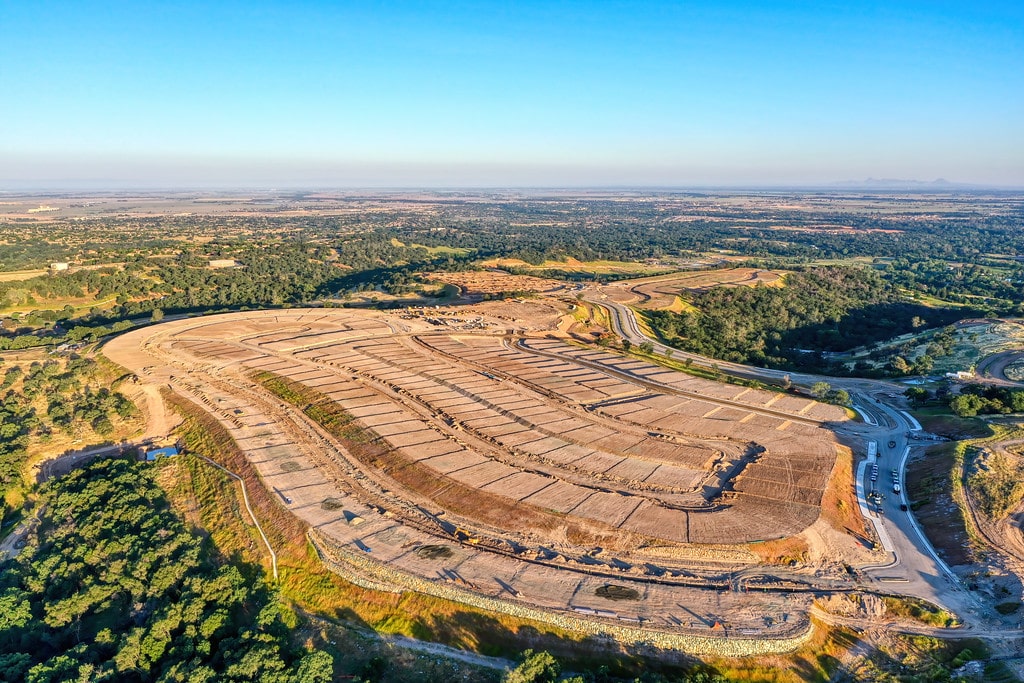
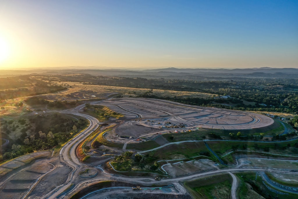
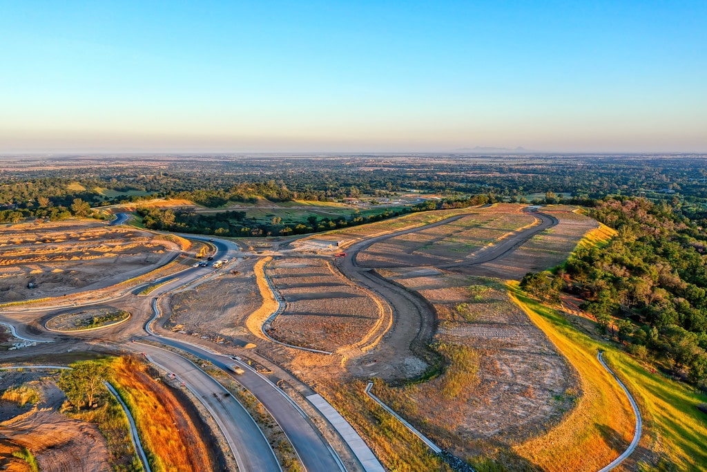
The property was then sold to local homebuilder JMC Homes and is now under construction.

Read more

APPROVED LAND USES INCLUDE:

  • Low Density Residential, 71 units
  • Park & Open Space, 7.5 acres
Land Use Map
Video

Westpark 3 & 4

OVERVIEW

Westpark Phase 3 is a 783 unit project located in the City of Roseville. Westpark acquired this property in December 2009 from Pulte Homes and repositioned this property with a redesign and amended infrastructure phasing plan, increasing the overall unit count and improving the cash flow requirements for the development of the property. The revised entitlements and agreements were approved in December 2010 and improvement plans prepared for the backbone infrastructure. Villages 13 and 15 were sold in April 2012 to Meritage Homes and KB Homes. The HDR property was sold to Alan Ives Construction, LLC in 2017.

Westpark Phase 4 is a 1,057 unit project, including 887 single-family lots and 170 multi-family units, located in the City of Roseville. Westpark acquired this property in December 2009 from Pulte Homes and repositioned the property with a redesigned site plan and re-engineered infrastructure phasing plan to reduce front-end expenses. The revised entitlements were approved in July 2013. The 1,057 units were sold to Pulte Homes and Lennar Homes in September 2013. In 2017, 11.4 acres of industrial land was sold to Westpark Storage and in 2019, another 21.1 acres was sold to the City of Roseville. The northernmost parcel of light industrial was deeded to the City of Roseville in 2020 in exchange for Fiddyment Parcel F-55. Parcel F-55 was mapped to include 99 LDR lots. This deeded acreage was combined with the City’s existing acreage and is now the Roseville Soccer Complex a much needed regional amenity.

Westpark 3 APPROVED LAND USES:

  • Low Density Residential, 533 units
  • High Density Residential, 250 units
  • Park, 4.3 acres

Westpark 4 APPROVED LAND USES:

  • Low Density Residential, 887 units
  • High Density Residential, 172 units
  • Industrial/Light Industrial, 88.1 acres
  • Elementary School, 8.5 acres
  • Parks, 14.0 acres
  • Open Space, 345.7 acres
Land Use Map
Video

Bickford Ranch

OVERVIEW

In the spring of 2013, Westpark Communities was approached by the holding company of Lehman Brothers to assist them with the repositioning of an asset they acquired through foreclosure and the bankruptcy of a previous business partner. The role of Westpark Communities in the property was unusual in that rather than a principal in the development of the property; we played the role as a consultant to Lehman Brothers Holdings, LLC.
The property was well known in the market having endured an 8+ year entitlement process in the late 1990’s into the early 2000’s that included very contentious public hearings and protracted litigation by local residents, regional and national environmental groups. Lennar Homes was the initial developer who completed the entitlements and had intended to commence with development when SunCal acquired the site in late 2005 and commenced development of the property including grading, off-site trunk sewer and water lines to serve the site. In 2008 all development ceased on the site and was left in various stages of completion, including half built sewer and water lines, and unfinished grading.

Westpark Communities task was to evaluate the then existing entitlements and regulatory permits as well as various agreements with utility providers and propose amendments to better reflect current market conditions. The original entitlements included 1,890 residential units, a 10 acre commercial site, 190 unit affordable multi-family site, and an 18-hole championship golf course. The residential mix was split evenly between conventional housing and age-restricted community that included the golf course as well as 2 community recreation centers. Included with the conventional product was a mixture of housing and lot options including large acreage lots (5+ acres) to attached townhome units. Our initial recommendation to Lehman Brothers was to keep the active adult community, but eliminate the golf course and replace it with open space that would include walking and hiking trails as well as more opportunity for open space view premiums. Removing the golf course also created opportunities to revise the residential portions of the land plan and create better residential neighborhoods. In addition, we recommended a revised grading strategy for the site to serve two purposes, it reduced the visibility of the development from neighboring properties but also allowed for a reduction in tree impacts.

The project was issued a US Army Corps of Engineers 404 Permit in 2007 and expired in February 2012, prior to our involvement in the project. Despite the prior non-compliance issues with the permit, Westpark Communities successfully negotiated an extension of the expired 404 permit without additional mitigation requirements and brought the property back into compliance with the Corps.

Westpark Communities reviewed the major infrastructure phasing plan for Bickford Ranch. The original plan had trunk sewer improvements coming from the west and the primary water supply coming from the east. This created an extremely costly phasing plan requiring significant offsite infrastructure and constructing infrastructure in some cases many years ahead of when it would otherwise be required. Working with the local service providers, Westpark Communities developed a phasing plan to bring both water and sewer to the site from the west, creating a much more favorable phasing plan than was previously in place. In addition, Westpark Communities looked for other infrastructure savings and efficiencies that ultimately lead to a backbone cost savings of more than 10% and nearly $40 million.

Despite the previous contentious entitlement process, Westpark Communities developed an outreach plan that included multiple community meetings with local planning committees to vet the changes to the plan and address issues ahead of public hearings. The project moved through the Planning Commission and Board of Supervisors with only a single dissenting vote. The Bickford Ranch project is currently being built out and includes neighborhoods by Shea Homes, Toll Brothers and Tri_Pointe Homes.

Read more

APPROVED LAND USES INCLUDE:

  • Low Density Residential, 1,890 units
  • Park, 60 acres
  • Open Space, 1,071 acres
Map View
Video

WestPark

OVERVIEW

Westpark is a 1,500 acre master planned community located in the City of Roseville and is part of the approved West Roseville Specific Plan.  Westpark is home to  4,585 households. The property was acquired in 1989 as raw, unentitled land and required a full complement of local entitlements including a General Plan Amendment, a Specific Plan, EIR, Development Agreement and annexation. Federal and State permitting was also required including issuance of a 404 permit from the US Army Corps of Engineers, a Biological Opinion from the US Fish and Wildlife Service, Water Quality Certification and Streambed Alteration Agreement from the State of California. The entitlement effort included extensive public outreach and community involvement resulting in broad support during the public hearing process and City of Roseville approval in 2004. Following approval, Westpark sold the master planned community to a consortium of builders that included Pulte Homes, Centex Homes and Lennar Homes. These builders began construction in 2005 and then stopped in 2008 with the collapse of the real estate market. Westpark then purchased Phases 3 and 4 back from the builders at the end of 2009.

APPROVED LAND USES INCLUDE:

  • Low Density Residential, 2,663 units
  • Low Density Residential (Age Restricted), 704 units
  • Medium Density Residential, 608 units
  • High Density Residential, 652 units
Land Use Map
Video